Our solutions
Geolite – Our Operations Control & PI system – reliable and quick to integrate
With Geolite, get an overview of your network at the depot or on the go, clear and accurate passenger information, and an optimized guidance system for drivers.
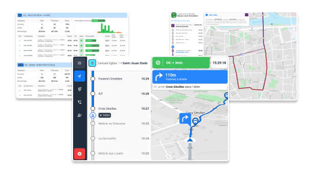
A daily support for drivers
Discover all the features included in the maps used in the Operations Control & PI system and the GPS-based training ecosystem.
01
Driver’s app
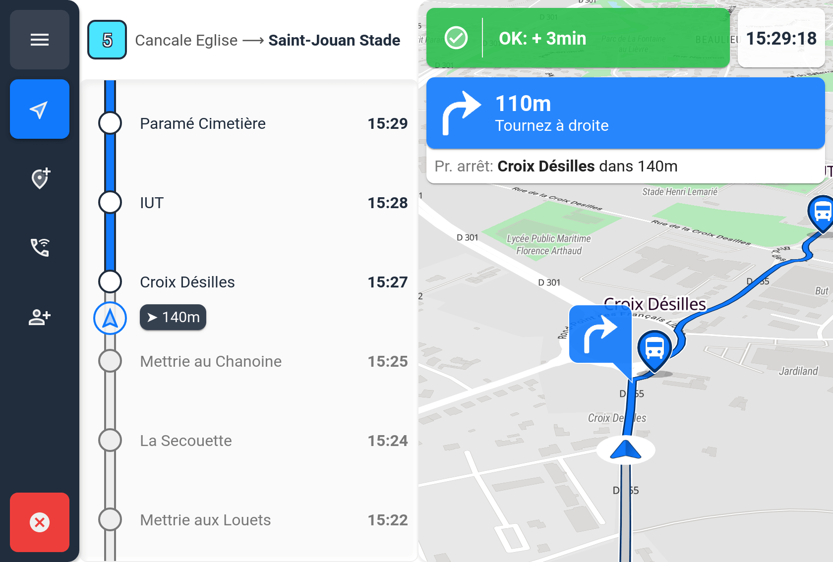
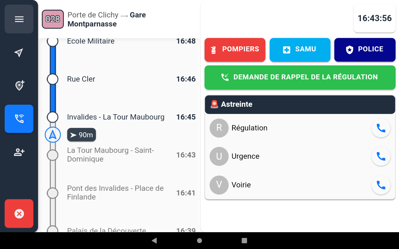
Geolite is reliable, comprehensive, and quick to set up. A real support for the driver, it displays line thermometer, GPS guidance with route exit redirections, level crossings, and calculates advances/delays at each stop…
02
Available readings
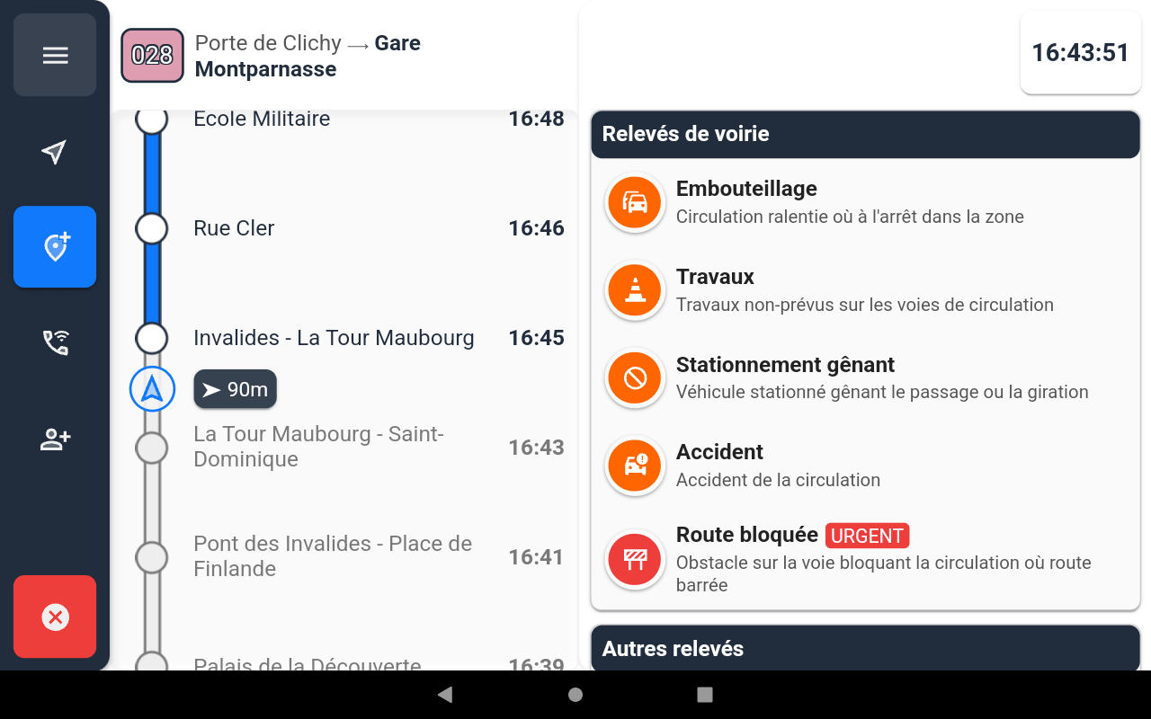
From the driver’s app, the user can carry out road surveys to inform the operation or other relevant services. The transmission of this data is valuable and contributes to an improved quality of service for the network.
03
VoIP calls
Thanks to VoIP, the driver can request a callback from the control center. This feature optimizes communication between drivers and the control center, ensuring effective coordination of transport operations.
04
Manual counting
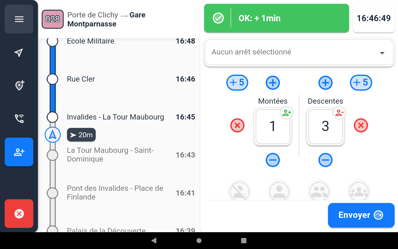
The driver can also inform the operation about passenger traffic on their service through a manual count available at each stop. Consequently, these data enable real-time adjustments to schedules and resources, ensuring a more responsive service tailored to the needs of passenger clients.
05
Regulation messages
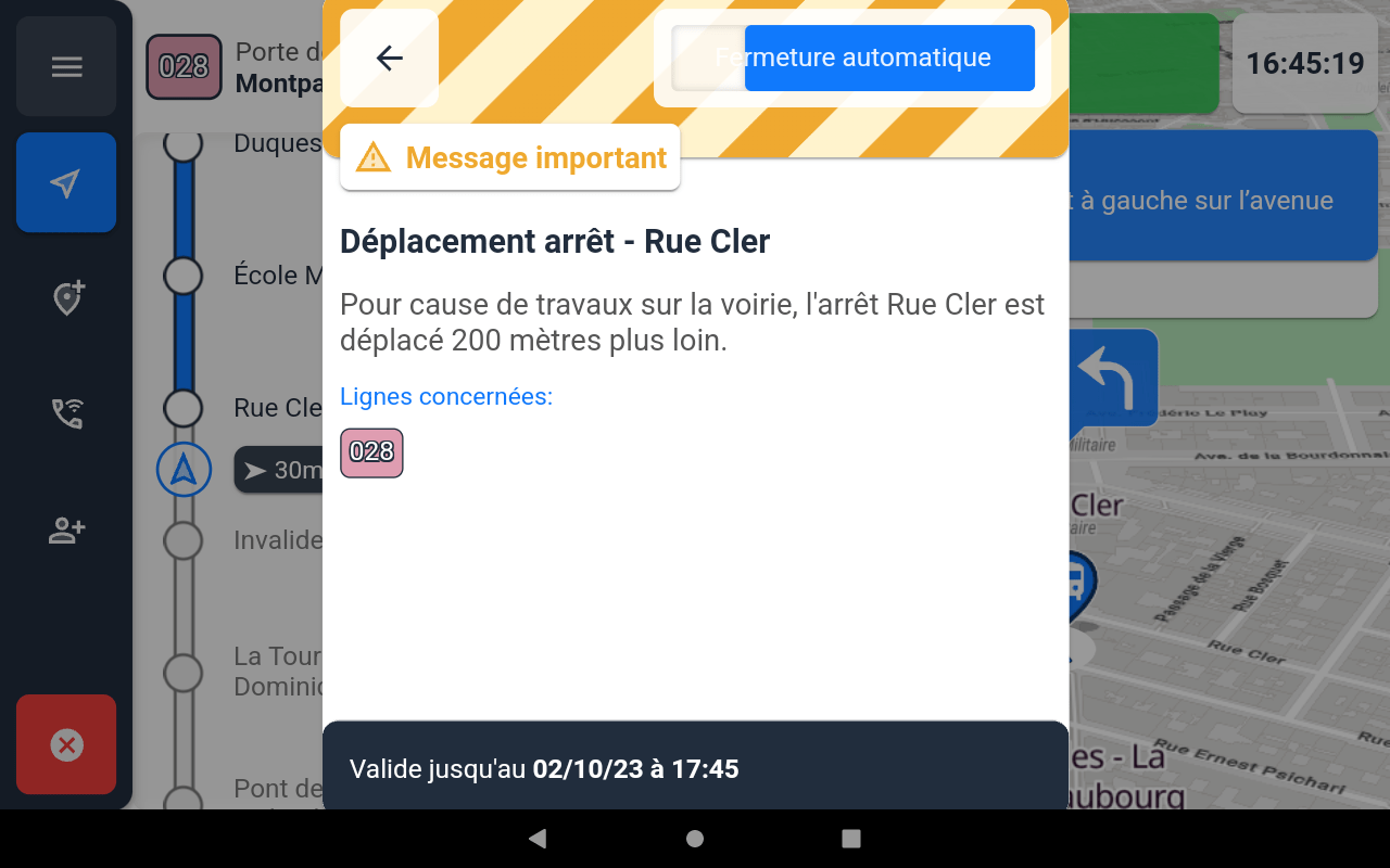
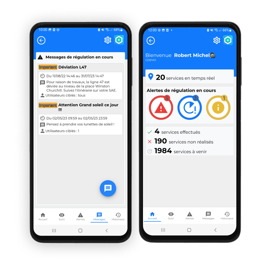
The operation has the possibility to inform the drivers of any possible incident (construction, detours, etc.) on their route. These notifications can be categorized by their severity level and displayed as a permanent or temporary pop-up window.
Clear and comprehensive passenger information
Provide the same quality of passenger information from urban, interurban, and school services through a dedicated app, a web portal, or a page that can be integrated into your own media.
Real-time mapping
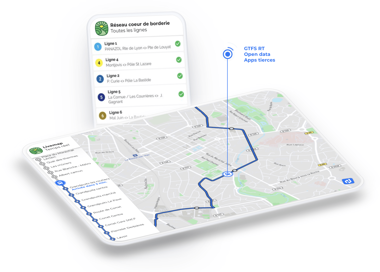
Our system tracks the real-time position of your buses, makes them available on the web, your passenger app, and on public open data via a GTFS-RT feed.
Real-time mapping
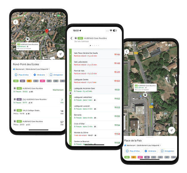
We can provide a passenger information access point that includes real-time positions, progress/delay, detours, and alerts, accessible through a link or QR code, or directly integrable into your website or app.
Inform your passengers in a precise and customizable manner
Maintain a trustful relationship with passengers by keeping them informed in real-time about the traffic status and possible disruptions.
Integrations with existing tools and hardware
Our systems connect to passenger information terminals, destination displays, on-board screens, and audio displays installed in vehicles for complete control of your equipment.
Passenger app
From the Android and iOS stores, passengers can directly download the app to track their bus, check schedules, and receive real-time alerts in case of disruptions.
We can also provide our app as a white-label solution; feel free to ask us about it!
GTFS RT
Manage your stream directly from our back office to provide what you need to your various service providers:
- Trip updates
- Vehicle positions
- Service alerts
We can even keep you informed about the current status of the theoretical schedule, especially so that you can update travel paces on a daily basis!
Need high-quality passenger information?
The management of your network
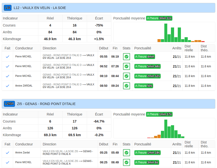
Stand out with a comprehensive tool for optimizing the quality of your network. Punctuality, scheduling and assignment of various types of missions, customization of access by operator, precise billing for kilometers traveled…
Punctuality and real-time vehicle tracking
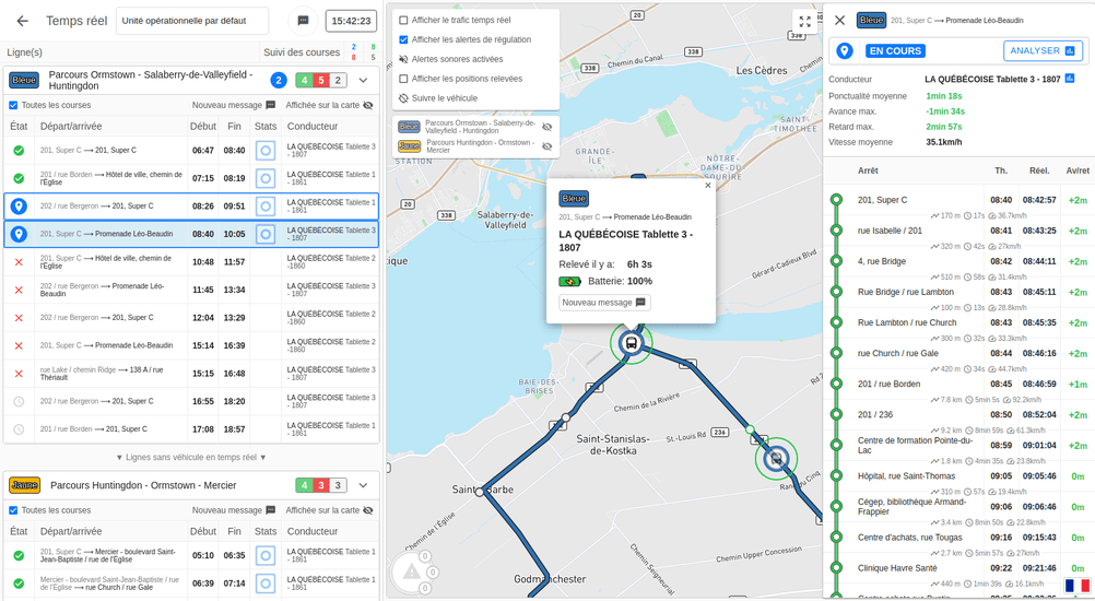
With Geolite, our Operations control & PI system, you have a complete visualization of all current and upcoming services in real time. Additionally, you are notified in case of early arrival or significant delay of vehicles at stops.
Detailed statistics
Enjoy detailed statistics about your network, gathered in one place: travel times, distances, average speeds, driver punctuality… These can be exported as a summary report or made directly accessible to the authorities in charge through the app.
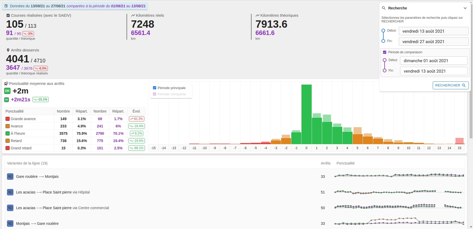
Average and compared punctuality
At the level of a trip, a line, or the entire network, choose punctuality and service quality indicators and compare several periods against each other.
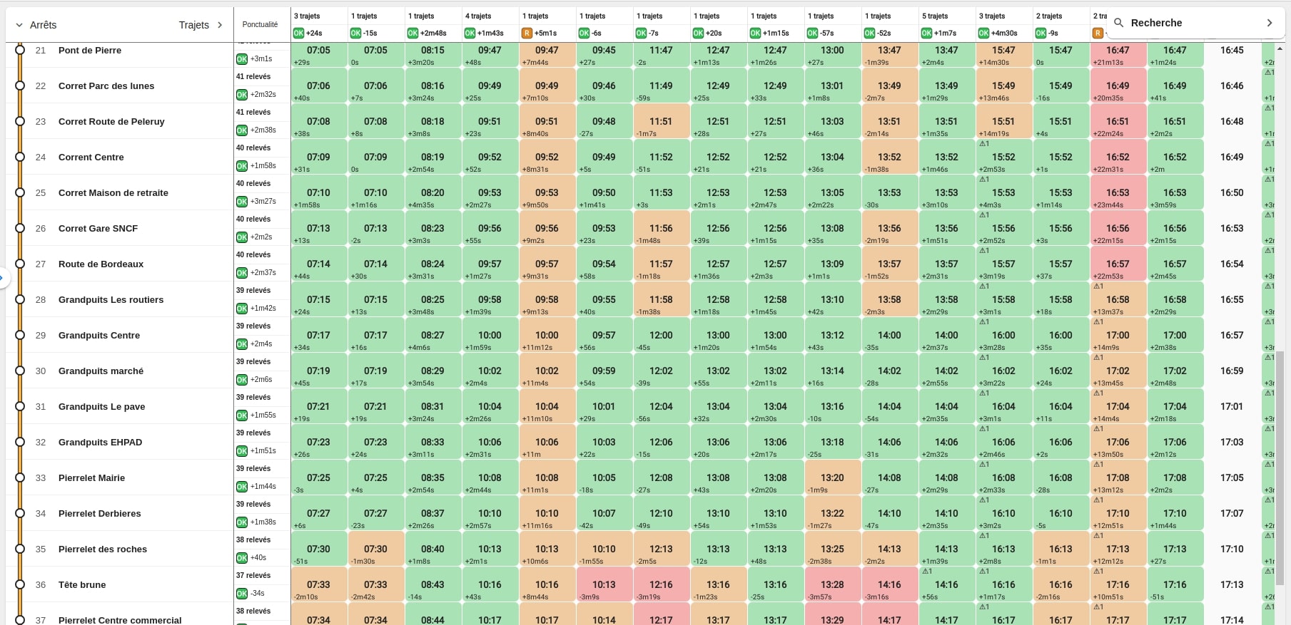
Fine analysis of stops
With precise readings, detect missed stops and areas and time slots of slowing and delay.
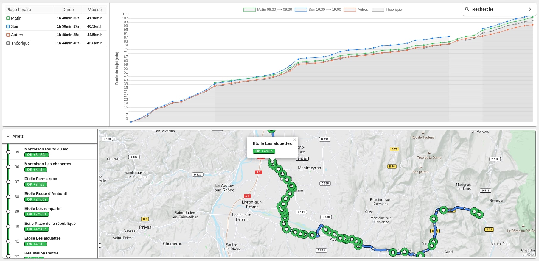
Inter-stop and speeds
Analyze inter-stop times and determine actions to take on schedules to optimize the theoretical offer.
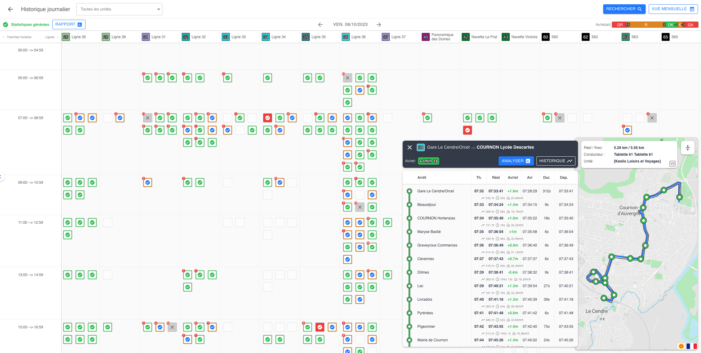
Detailed operational report
Receive daily and monthly reports detailing overall and line-by-line services, automatically by email in simple formats.
Need high-quality efficient tools?
Geowatch, Mobile regulation application
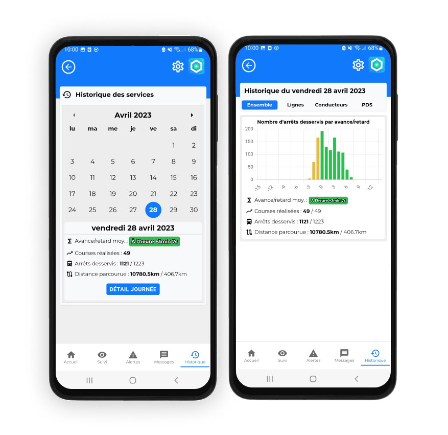
You do not have a central control center or you are off-site? You can now manage your network from aywhere with our lightweight and efficient control app that fits right in your pocket!
Mobile regulation app
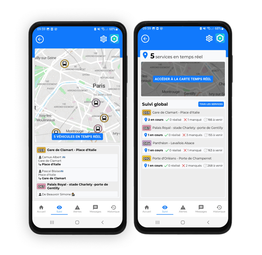
Track the real-time position of buses, their scheduled arrival times at stops, and any potential delays. Stay informed about stops not being served on each route… Our mobile control is as comprehensive as it is intuitive!
01
Track your network in real-time
With the livemap, visualize all ongoing, completed, missed, and upcoming services.
02
Messages, alerts, and notifications on the go
Transmit and receive messages as well as regulation alerts effortlessly from your smartphone, and be notified through notifications in case of urgent regulation alerts.
03
History, trip replay, and statistics
With one click, access operational reports for your routes and benefit from detailed statistics on the services provided: position history, stops served, distances traveled…
