FLEXNAV
your driving companion
Available as a driver app, operator portal, and driver portal, our solution is designed to train and reassure your drivers, enabling them to confidently navigate new routes in case of restructurings or substitution.
A solution
tailored to every situation.
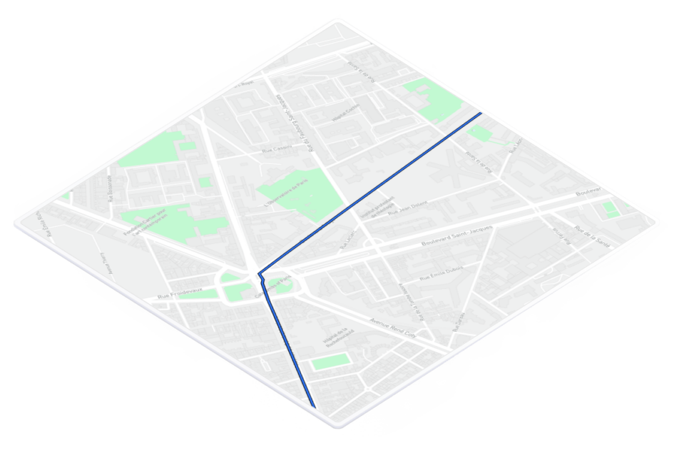
Available on iOS and Android, the Flexnav solution is fully adapted to the constraints of buses and coaches. Stop points, guidance instructions, accident-prone zones, driving tips... Your drivers are guided throughout the entire journey.
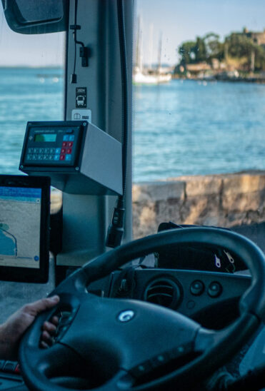
Our Driver App
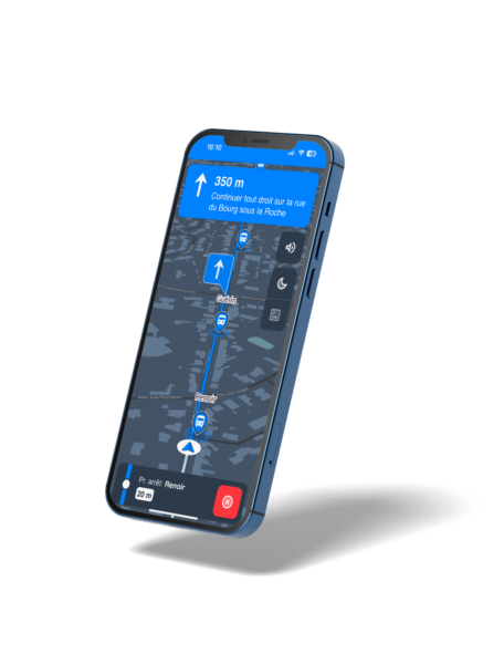
Driving comfort
On tablet or smartphone, your drivers benefit from our expertise in guidance tailored to the constraints of heavy vehicles and optimized geolocation for passenger transport. In case of route deviations, your driver is redirected to the next stop.
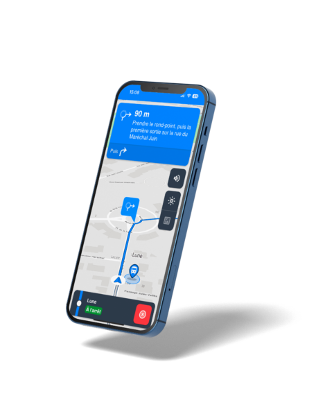
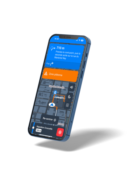
Visual and audio guidance
Your drivers follow the route and benefit from driving tips, both visual and audio, generated automatically and fully customizable. Voice-based tips can also be generated.
The GPS takes into account danger zones, tunnel areas, level crossings, and re-routing routes. These can be customized from the operator portal.
Risk zones
Night mode
Our maps automatically adjust based on the time of day and the season, ensuring optimal comfort at the driver's station.
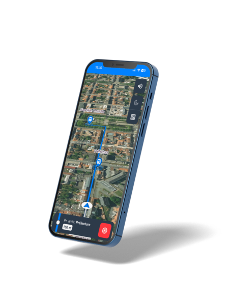
Satellite view
During route mapping or reconnaissance, benefit from satellite map display to better visualize stop points and complex areas.
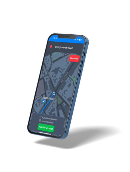
Field recording
On the field, record a route yourself using optimized geolocation and add the line's stops.

Laurent Freppaz
KEOLIS VAL DE SAONE
The Flexnav tool is widely used! Today, we achieve a 99.9% service quality rate for routes through this tool.
CUSTOMER
REVIEWS
Sébastien Michel
TISSE
Flexnav has been a key ally in the restructuring of our network. This tool has allowed us to train and support our drivers effectively.
Flexnav is intuitive, easily adaptable, and allowed us, notably this summer, to prevent seasonal drivers from leaving due to a lack of confidence.
TRANSDEV ROYAN
Xavier Lebosse

a rich
and comprehensive map

A readable and efficient
map background.
At Hubup, our driver guidance systems use lightweight and fast map backgrounds. They display only the information necessary to optimize the visibility of intersections for the driver. The map is also available in night mode, which is automatically activated to minimize visual discomfort for the driver.
A precise and fully
customizable route.
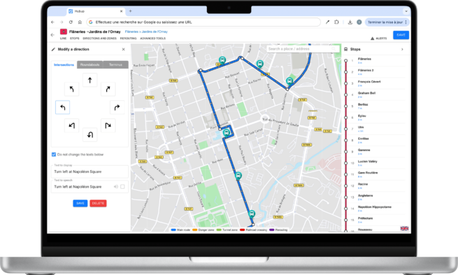
With Hubup tools, automatically trace the routes of your lines in just a few seconds. You have the option to finely configure specific sections such as dedicated lanes or bus stations. Do you have GTFS with route data? KML or XML files? We take care of importing all your data to simplify the launch!
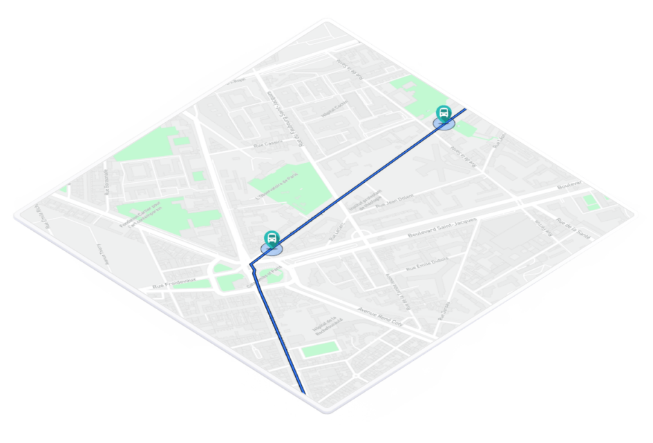
A detailed management
of stop points.
Imported from a GTFS, an Excel list, or created manually, the stops can be positioned to the exact meter and verified using Google StreetView. Drivers thus have a reliable reference for the stops to be served.
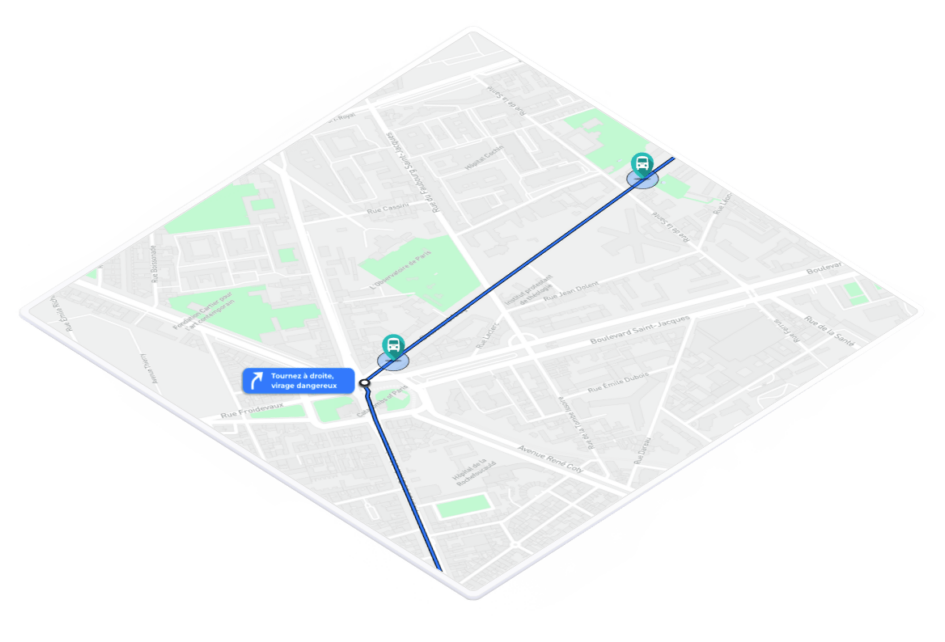
Driving tips, at the right place,
at the right time.
Guidance instructions are generated automatically during the route mapping for better driving comfort. You can create or modify them to add more specific instructions.
Identification and announcement
of accident-prone zones.
Allow your drivers to benefit from the expertise of your trainers in the field. By adding fully customizable danger zones to the route, you increase driver awareness and reduce accidents.
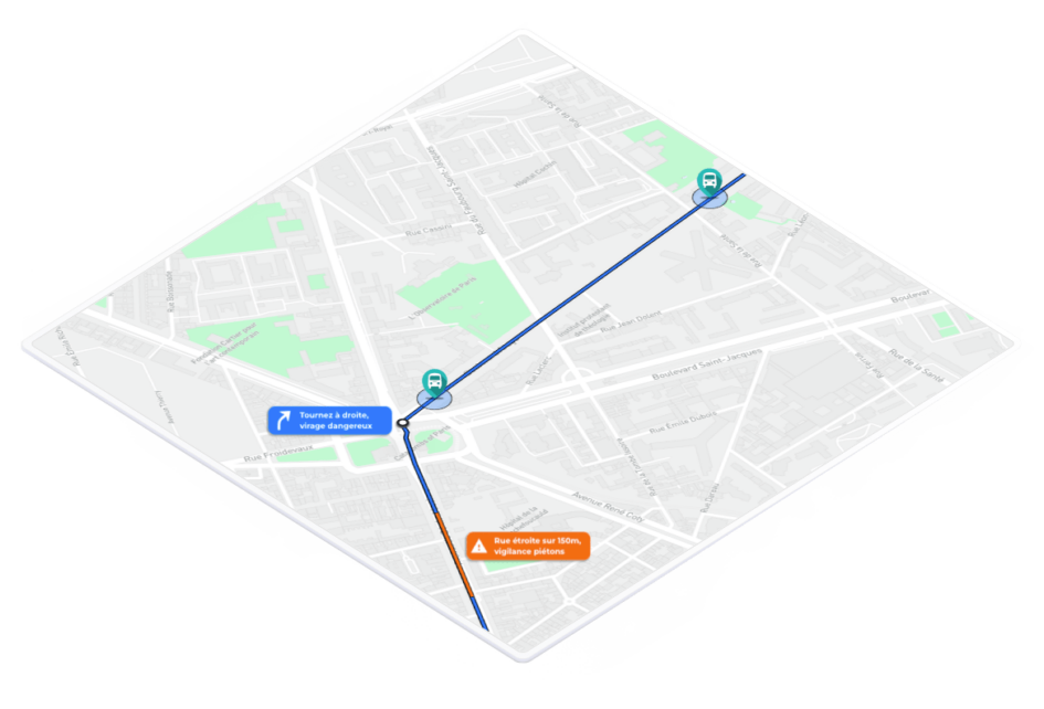
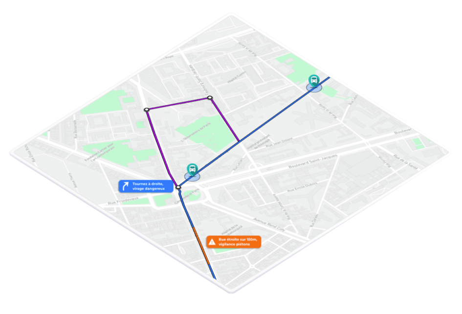
A rerouting in case
of route deviations.
If intersections are identified as common sources of errors, or if certain accesses frequently require rerouting, you can configure supervised rerouting paths. In case of a route deviation, the driver is automatically redirected to the route. They will resume the default journey as soon as they rejoin it.
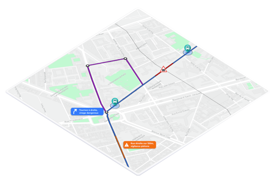
An automatic warning
for level crossings.
A visual and audio alert is automatically sent to drivers when approaching a level crossing to increase their awareness and reduce the risk of accidents, all without requiring any configuration from you.
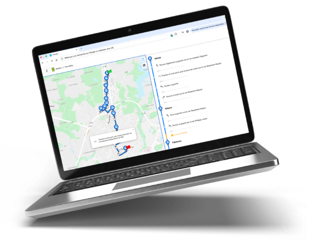
Our Back Office
We integrate your GTFS, and you can easily find all your routes, clearly and organized, on our interface.
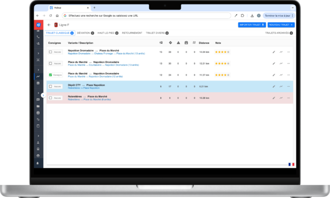
Quick implementation
Each route is customizable and adapted to the constraints of heavy vehicles. Define automatic or configurable audio announcements for stop points, direction changes, risk zones, etc. All in just a few clicks, with no need for recording!
Modification of routes
and audio announcements
Training hours, mobile consultation, web consultation... Obtain precise statistics for the period of your choice, by center, by line, and by variant.
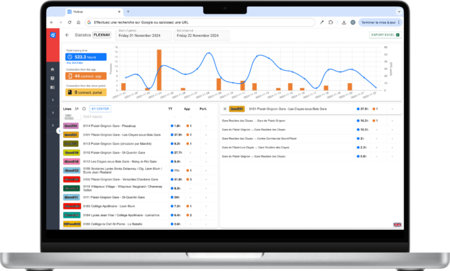
KPIs and Statistics
The training GPS Flexnav is listed as product by Transdev.

The training GPS Flexnav is listed as product by Keolis.
Focus on
Since November, Keolis Basque Adour has equipped itself with 7 tablets to train or retrain its drivers on its 45 routes. Amid recruitment during peak activity periods and the increased absenteeism caused by COVID, Flexnav has helped simplify operations while reassuring drivers on the ground.
In addition to real-time guidance, KBA drivers on the Txik Txak network (formerly Chronoplus) benefit from the web portal to preview their routes: photos, Street View, written and oral instructions, and route guidelines... Everything is designed to help drivers familiarize themselves with the routes as effectively as possible.
On the operations side, beyond simplifying replacements, Flexnav helps maintain services even during detours, construction, or stop changes... With just a few clicks, a route can be created and/or modified, enabling any driver to be sent to the route as quickly as possible. Customer service is ensured and of high quality.
Keolis Basque Adour has chosen Flexnav, the training GPS, to support its 250 drivers in learning the routes of its urban and suburban network.
250
45
7
Drivers
Tablets
Lines

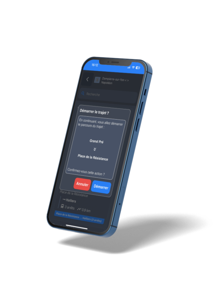
The Driver Portail
A true training ecosystem, Flexnav also allows your drivers to preview routes in advance, from a computer or smartphone. Through this portal, the driver can download instructions in PDF format and even view photos of attention points identified by the operations team!
Visualization